
By Business Insider Reporter
Africa’s growing investment in geospatial technology is beginning to pay dividends – not only in environmental conservation but also in economic planning, climate resilience and natural resource management.
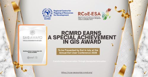
That reality was reinforced this week after the Regional Centre for Mapping of Resources for Development (RCMRD), an intergovernmental institution of which Tanzania is a member, received one of the world’s highest honours in geographic information systems (GIS).
The Nairobi-based institution won the prestigious 2026 Special Achievement in GIS (SAG) Award, presented by US technology giant Esri during its annual international user conference in San Diego, California.
According to a statement released by the institution today, the award recognises organisations that are transforming decision-making through innovative use of geospatial technologies and data analytics.
For Tanzania, the recognition goes beyond institutional prestige. It signals the growing strategic importance of geospatial intelligence in supporting the country’s ambitions under Dira 2050, where evidence-based planning, climate resilience and sustainable management of natural resources are expected to play an increasingly central role.
RCMRD’s award-winning work is anchored in the Regional Centre of Excellence (RCoE), an initiative funded by the European Union that supports biodiversity conservation, forest management and seascape ecosystems across Eastern and Southern Africa.
Through advanced satellite imagery, digital mapping platforms and spatial analytics, the programme enables governments to make faster and more informed decisions on land use, protected areas and environmental management.
The significance for Tanzania is considerable.
As one of Africa’s most biodiversity-rich countries – home to the Serengeti ecosystem, Ngorongoro Conservation Area, Selous, Ruaha and extensive marine protected areas – Tanzania increasingly depends on reliable environmental data to balance conservation with tourism, mining, agriculture and infrastructure development.
Accurate geospatial information has become a strategic economic asset.
From identifying climate risks affecting agriculture to monitoring forests that generate carbon credits, modern mapping technologies are now helping governments and investors reduce uncertainty while improving long-term planning.
According to RCMRD Director General Dr. Emmanuel Nkurunziza, the organisation has spent nearly five decades strengthening Africa’s ability to manage its own natural resources.
“This award affirms that geospatial innovation, built in partnership with our member states and the European Union, is delivering real impact where it matters most: on the ground, ahead of the 2030 deadline the world has set for itself,” he said.
The award also reflects Africa’s growing role in applying digital technologies to address environmental and development challenges.
RCMRD currently supports 24 countries in Eastern and Southern Africa by providing regional geoportals, biodiversity maps, policy tools, automated country profiles and capacity building that allow governments to monitor ecosystems and measure progress toward international biodiversity commitments.
Esri President Jack Dangermond said organisations recognised through the SAG Awards demonstrate how location intelligence is becoming indispensable in solving global challenges.
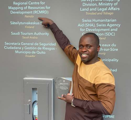
“They are using GIS not only to improve their own decision-making but are innovating through their work to the benefit of our whole geospatial community,” Dangermond said.
For investors, such capabilities are becoming increasingly valuable.
Development finance institutions, insurers and multinational companies now rely heavily on geospatial intelligence to assess climate risks, identify suitable investment locations, monitor infrastructure projects and evaluate environmental compliance.
This means institutions like RCMRD are no longer simply scientific organisations; they are becoming critical enablers of investment.
The award also highlights the European Union’s expanding investment in African science, innovation and digital infrastructure through the Africa Regional Centres of Excellence (ArcX) Programme, which supports research across biodiversity, water resources, climate change, agroecology and marine ecosystems.
As Tanzania seeks to accelerate industrialisation while protecting its vast natural capital, access to sophisticated geospatial intelligence is likely to become as important as roads, ports and power infrastructure. The recognition of RCMRD therefore represents more than an international award. It signals Africa’s emergence as a producer—not merely a consumer – of world-class geospatial innovation capable of supporting smarter investments, sustainable development and evidence-based economic transformation.